


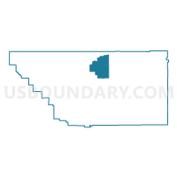
Voting District 10050, Kern County, California
About
Outline

Summary
| Unique Area Identifier | 531209 |
| Name | Voting District 10050 |
| County | Kern County |
| State | California |
| Area (square miles) | 258.07 |
| Land Area (square miles) | 257.67 |
| Water Area (square miles) | 0.40 |
| % of Land Area | 99.84 |
| % of Water Area | 0.16 |
| Latitude of the Internal Point | 35.60170030 |
| Longtitude of the Internal Point | -118.70953010 |
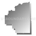
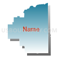
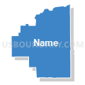
Maps


Graphs
Select a template below for downloading or customizing gragh for Voting District 10050, Kern County, California


Neighbors
Neighoring Voting District (by Name) Neighboring Voting District on the Map
- Voting District 10000, Kern County, CA
- Voting District 10005, Kern County, CA
- Voting District 10040, Kern County, CA
- Voting District 10045, Kern County, CA
- Voting District 10510, Kern County, CA
- Voting District 10515, Kern County, CA
- Voting District 10520, Kern County, CA
- Voting District 10585, Kern County, CA
- Voting District 10620, Kern County, CA
- Voting District 10625, Kern County, CA
- Voting District 10650, Kern County, CA
- Voting District 10920, Kern County, CA
- Voting District 10925, Kern County, CA
- Voting District 20390, Kern County, CA
Top 10 Neighboring County Subdivision (by Population) Neighboring County Subdivision on the Map
Top 10 Neighboring Elementary School District (by Population) Neighboring Elementary School District on the Map
- Bakersfield City Elementary School District, CA (185,976)
- Delano Union Elementary School District, CA (54,938)
- Kernville Union Elementary School District, CA (11,432)
- Caliente Union Elementary School District, CA (915)
- Linns Valley-Poso Flat Union School District, CA (612)
- Blake Elementary School District, CA (169)
Top 10 Neighboring Secondary School District (by Population) Neighboring Secondary School District on the Map
Top 10 Neighboring State Legislative District Lower Chamber (by Population) Neighboring State Legislative District Lower Chamber on the Map
Top 10 Neighboring State Legislative District Upper Chamber (by Population) Neighboring State Legislative District Upper Chamber on the Map
Top 10 Neighboring 111th Congressional District (by Population) Neighboring 111th Congressional District on the Map
Top 10 Neighboring Census Tract (by Population) Neighboring Census Tract on the Map
- Census Tract 52.04, Kern County, CA (6,158)
- Census Tract 52.01, Kern County, CA (5,397)
- Census Tract 51.04, Kern County, CA (3,253)
Top 10 Neighboring 5-Digit ZIP Code Tabulation Area (by Population) Neighboring 5-Digit ZIP Code Tabulation Area on the Map
- 93306, CA (64,587)
- 93308, CA (52,447)
- 93240, CA (6,056)
- 93285, CA (2,536)
- 93518, CA (1,146)
- 93226, CA (282)
- 93220, CA (211)